RIVER RESTORATION
Restoring our watershed’s ecosystem.
The Charles has a long history of human intervention.
For centuries, it has been altered, dammed, and polluted for the benefit of human industry and development. Consequently, the river suffers impaired water quality, loss of habitat, and impeded fish passage. With climate change bringing more frequent and severe storm events, the Charles River is ill-equipped to handle the predicted flood and drought events. By removing defunct dams, tracking invasive species, daylighting streams, and more, we work to restore the river's natural ecology and build climate resilience.


What we’re doing about it:
-
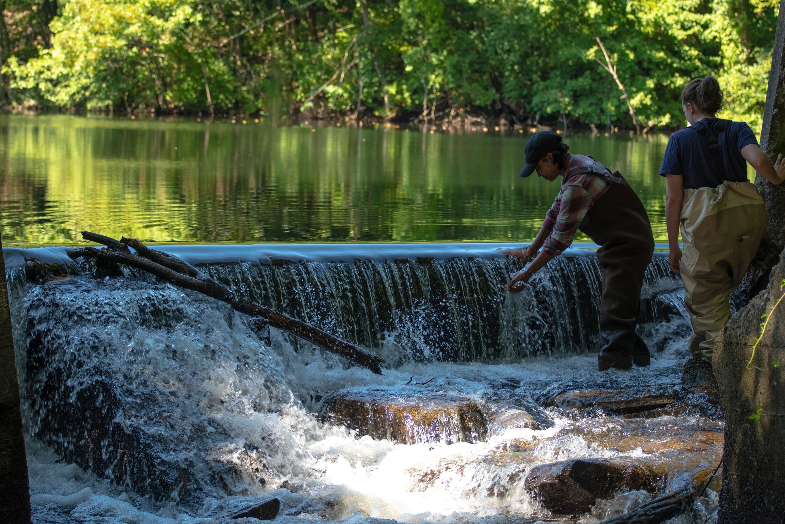
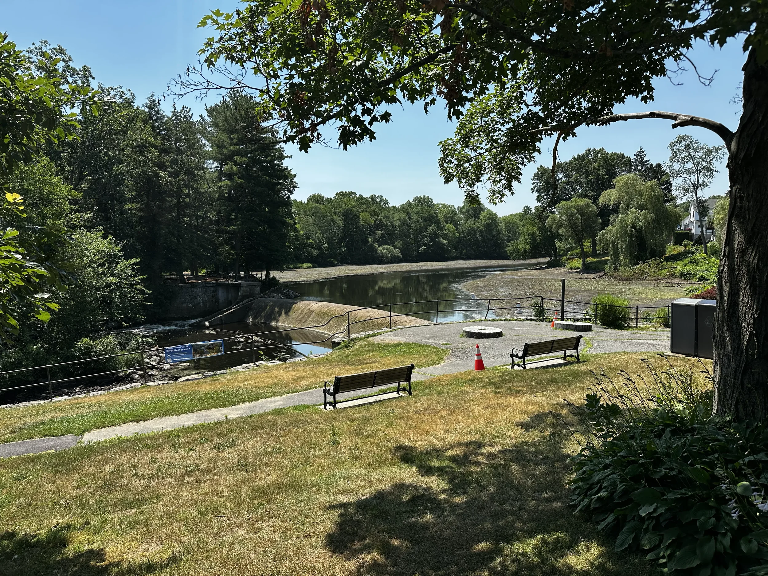
Dam Removal
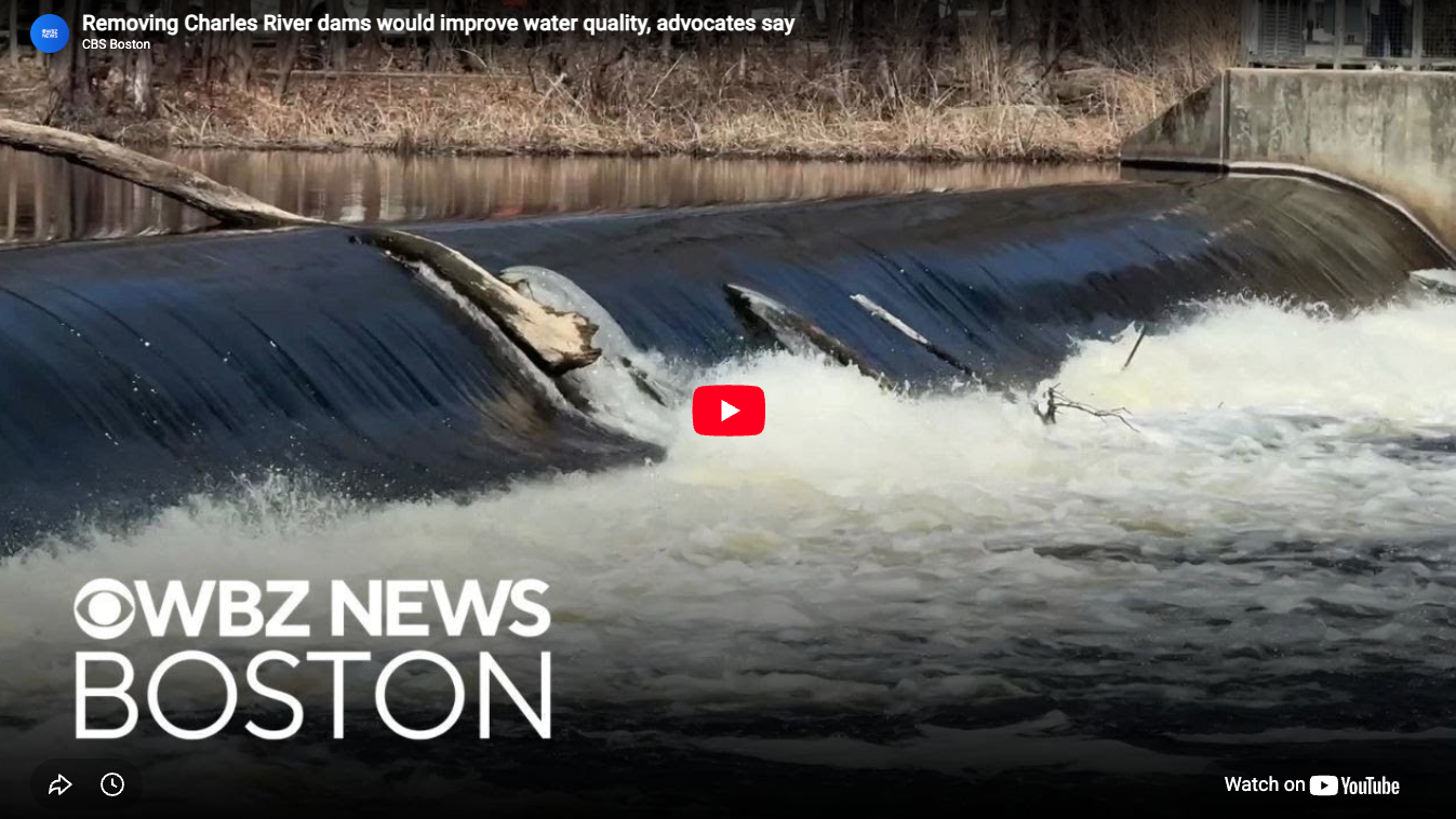
CRWA advocates for the restoration of the Charles River through the removal of defunct dams. These dams, which no longer serve a purpose, exacerbate problems for the river, such as impaired water quality, obstructed fish passage, and invasive plant species growth.
-

Stream Restoration
CRWA also addresses the condition of the Charles River’s tributaries, many of which face issues surrounding poor water quality, abundant invasive plant species, and impaired fish passage similar to the Charles itself. Through planning for riverbank restoration at impaired streams such as Cheesecake Brook in Newton and involving the community in its efforts, CRWA advances a vision of a healthier watershed for humans and wildlife.
-

Invasive Plant Management
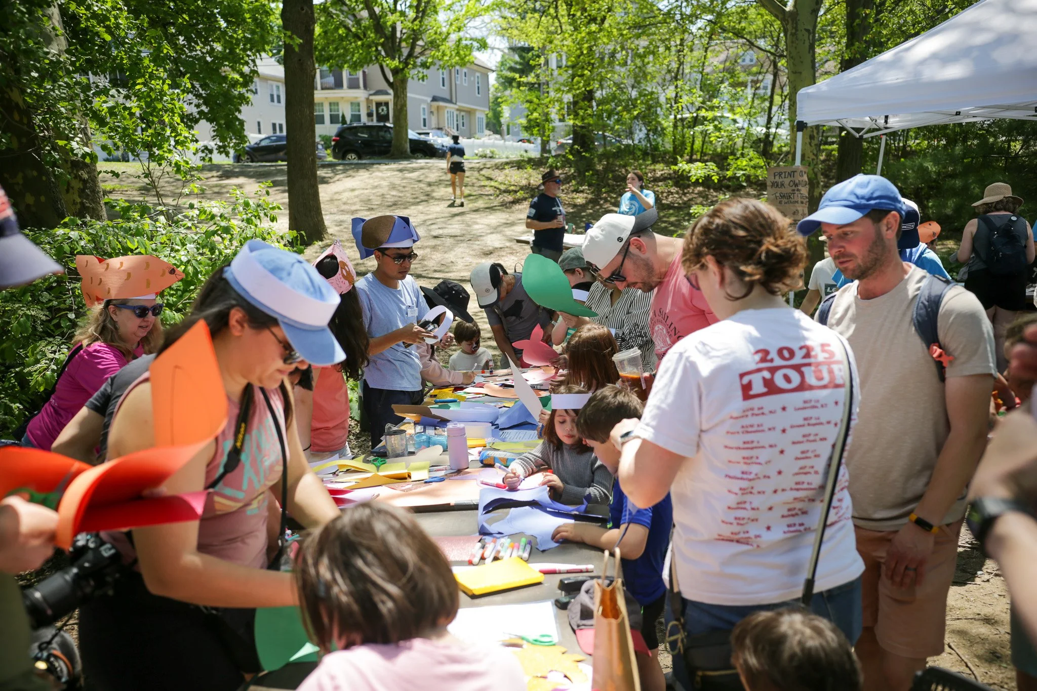
For over 15 years, CRWA has led volunteer outings to remove invasive plant species. Invasive plants – particularly fast-growing non-native plants whose growth can outpace that of native species – lower biodiversity in the watershed by outcompeting native plants, reducing habitat for wildlife, and killing mature trees.
-

Preserving Wetlands
CRWA is dedicated to preserving local wetlands in order to protect important habitat and mitigate flood damage. CRWA’s recent work includes advocating for the restoration of priority areas within the Charles River Natural Valley Storage Area, an expansive network of wetlands in the watershed originally protected in 1974.
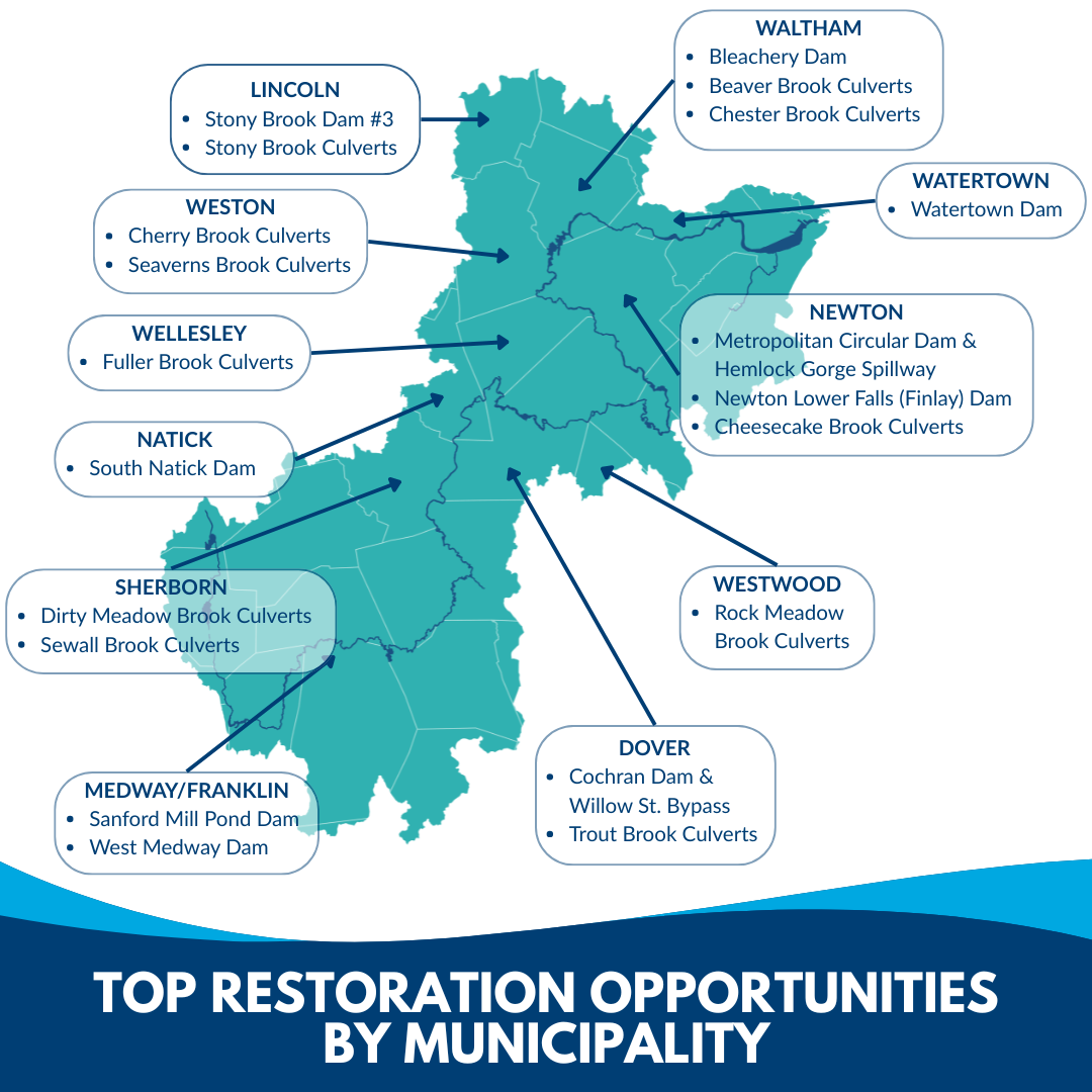
Charles River Watershed Restoration Plan
Over the past 400 years, the Charles River and its streams have been physically altered, resulting in poor water quality, habitat loss, blocked fish passage, and exacerbated flood and drought events. CRWA developed a watershed-wide restoration plan to address these issues by identifying and prioritizing restoration opportunities. Here, we considered aquatic barrier removal projects, specifically, dam removals and culvert replacements.
Restoration Planning Efforts
-
Culvert definition: “A drain or waterway built transversely under a road, railway, or embankment, usually consisting of a pipe or covered channel of box section.” (Mass. Department of Conservation and Recreation, 302 CMR 10).
Scoring definition: The North Atlantic Aquatic Connectivity Collaborative (NAACC) uses a complex scoring system for culverts based on a variety of parameters, including water velocity, water depth, and the presence of physical barriers to water flow. Each culvert is assigned a score from 0.0-1.0. This range of scores is uniformly broken up into the classes seen in the legend for the map, with “No barrier” representing a perfect score of 1.0.
-
Hazard level represents hazard potential classification, which signifies the predicted damage which the failure of the dam would cause if the failure were to occur. It does not relate to the condition of the dam.
A dam with low hazard is one whose failure is not expected to cause loss of life but may cause minimal property damage.
A dam with significant hazard is one whose failure “may cause loss of life and damage to home(s), industrial or commercial facilities, secondary highway(s) or railroad(s) or cause interruption of use or service of relatively important facilities.”
A dam with high hazard is one whose failure “will likely cause loss of life and serious damage to home(s), industrial or commercial facilities, important public utilities, main highway(s) or railroad(s).”
Condition represents an evaluation of the dam condition. Dams are assigned a condition of “good,” “satisfactory,” “fair,” “poor, “or “unsafe” by inspectors. These data are not as easily available for the public and were thus collected by CRWA, which added categories relating to whether a dam is breached; this “indicates the water level is at streambed elevation and the dam is not impounding water.” (from Mass. Department of Conservation and Recreation, Office of Dam Safety)
Fish passage communicates whether a dam allows for the movement of fish, for some species of fish travel between marine and freshwater environments. A structure known as a fish ladder can be installed to allow fish moving upstream to move past a dam.
-
This layer shows previously aboveground streams which humans have buried underground, often to make room for development. See CRWA’s page on stream restoration for examples and context.
Credits:
MIT Design for America (Cat Lu, Nhung Van, and Kerri Lu)
Andy Atallah, Watershed Restoration Intern at CRWA
Recent News.