
Is Your Home Prepared for the Next Big Storm? New Digital Tool Maps Local Flood Risks
As extreme weather events become more frequent, residents across the Charles River watershed now have a powerful new way to see exactly how these storms could impact their homes, streets, and community.
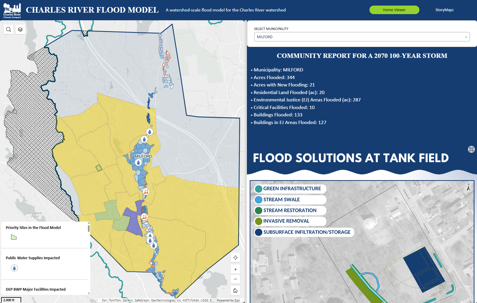
A collaboration between the Charles River Climate Compact (CRCC), the Charles River Watershed Association (CRWA), and Weston & Sampson Engineers has resulted in the development of the Charles River Flood Model (CRFM), a computer simulation that shows where and when flooding will occur in the watershed as the climate changes. While the model has been supporting city staff and planners for the last few years, this latest update is designed with a new audience in mind: you, the resident.
Climate change, flooding, and your community
The new online viewer allows you to look up your specific town and neighborhood to see how future storms - including major events like a 2070 100-year storm - could impact your surroundings. Instead of guessing, you can now visualize the potential flood risks that extreme rainfall might pose to your own block.
"Data democracy has been a core value of this initiative from the very start," says CRWA team lead Julie Wood, “these latest changes should also enhance data accessibility and help make model results more digestible and useful.”
How you can be part of the solution
The new model isn’t just for viewing flood risks; it’s an invitation to act! Here is how you can help protect your neighborhood:
Support local resilience initiatives: The updated web display shows off the impacts to a community and also highlights possible solutions. In some communities, this is site specific projects! Let your local officials know you support these projects or initiatives.
Evaluate your emergency preparedness: If the model shows your area is at risk, don’t panic. These are changes anticipated in the coming decades, not immediately. Also, model results are not official flood plain maps. However, you may want to think about making a plan in the event of flooding at or near your property.
Share your local knowledge: If you don't see immediate flood risks in your area but know of spots that could benefit from mitigation, the team wants to hear from you. They are looking for potential locations for underground storage, wetland restoration, or green infrastructure.
Get involved: If you have an idea for a project, you can reach out directly to the climate resilience team at jwood@crwa.org
Get started
You can explore the interactive map yourself by visiting the new CRFM viewer and selecting your town. Stay tuned for additional community-specific info sheets coming online soon.