
Where have you seen flooding in Milford?
The Milford Community Flooding Survey is LIVE and already doing its part to inform project partners about the areas where residents see the most flooding. It’s no secret that the watershed has been affected by a persistent drought this entire year so far, making live flooding reports hard to come by. Still, historical flood experiences have informed the Flood Survey project with enough information to prioritize habitual areas of concern for flood mitigation designs. The majority of the areas identified to date are situated within the Godfrey Brook subwatershed, an area with dedicated funding for green infrastructure and flood mitigation projects through the Municipal Vulnerability Preparedness Program.
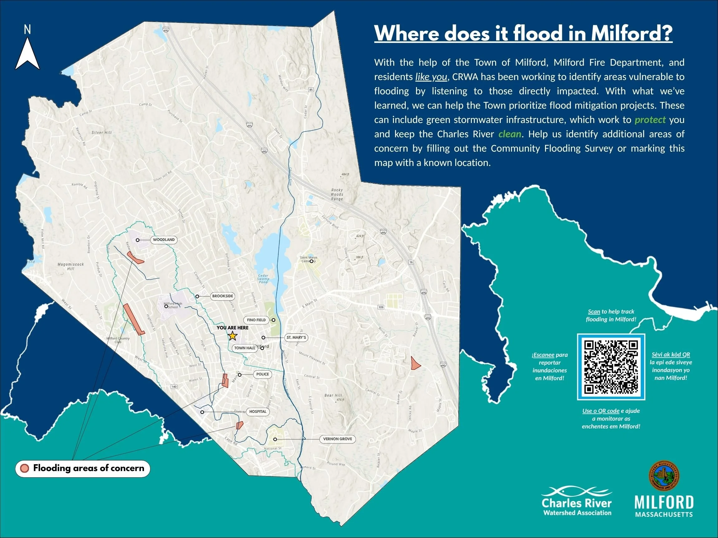
Within the Godfrey Brook subwatershed, critical facilities like schools, the police station, the power plant, and the hospital increase risk to major service outages in the event of extreme flooding. Along the headwaters of Godfrey Brook, Salvia Drive and Redwood Drive were identified as areas of concern, directly abutting the stream. A resident shared concerns with their entire street flooding during rain events, highlighted in the area along Hancock Street. Within Godfrey Brook itself, neighborhoods along Thayer Street and South Main Street reported persistent flooding. Finally, the area nestled between Maple Street and Beaver Street were highlighted as well.
The Milford Flooding Survey is still live! Help take part in combating flooding areas of concern by reporting current and past sightings of flooding.